


After 'tackling the Tourmalet' on Thursday afternoon we had taken a short drive that
had allowed us to move slightly west to an adjacent valley, where we
had based ourselves in the small town of Cauterets. Our plan was to
try out a few hikes in the Haute Pyrenees and this small town looked
like a good staging post.

With the sunny
weather continuing on Friday we rose early and enjoyed some morning
exercise and a healthy breakfast before donning our hiking gear and
setting off into the midday sun. Our aim was to head up the slopes of
Pic du Monne, or as some signs called it 'Moun Ne' (no the missing
't' is not a typo'). Standing more than 1800m above our motorhome the
rocky twin summits of Pic du Monne and nearby Pic de Liou (2565m)
looked like a daunting task and we knew that with just 6-7 hours of
daylight left that we were unlikely to make the summit, but we'd see
how we got on.

Unlike in the
Alps, where we had found excellent signs marking routes to pretty
much any nearby summit or col, we actually had a hard time finding
any signs at all to point us in the direction of the lower paths
marked on our map. As we were using the 1:50,000 Carte de Randonees
series (No. 4 for this area) it was hard to make out the tangle of
streets in Cauterets, but after a few false starts and an uncertain
half an hour or so we did emerge onto an identifiable slope and began
the long climb upwards.

The weather was
amazing, and from this east facing slope the view over towards the
ridge above Luz Ardiden was beautiful and as we climbed higher the
peaks to the south began to open up as well as we could see over the
nearby hills. After 2 hours of climbing we took a pause for lunch and
considered our options. It was already 3pm, but the summit looked so
inviting, so we decided to push on for another hour or so before
turning around. It was definitely the right choice.
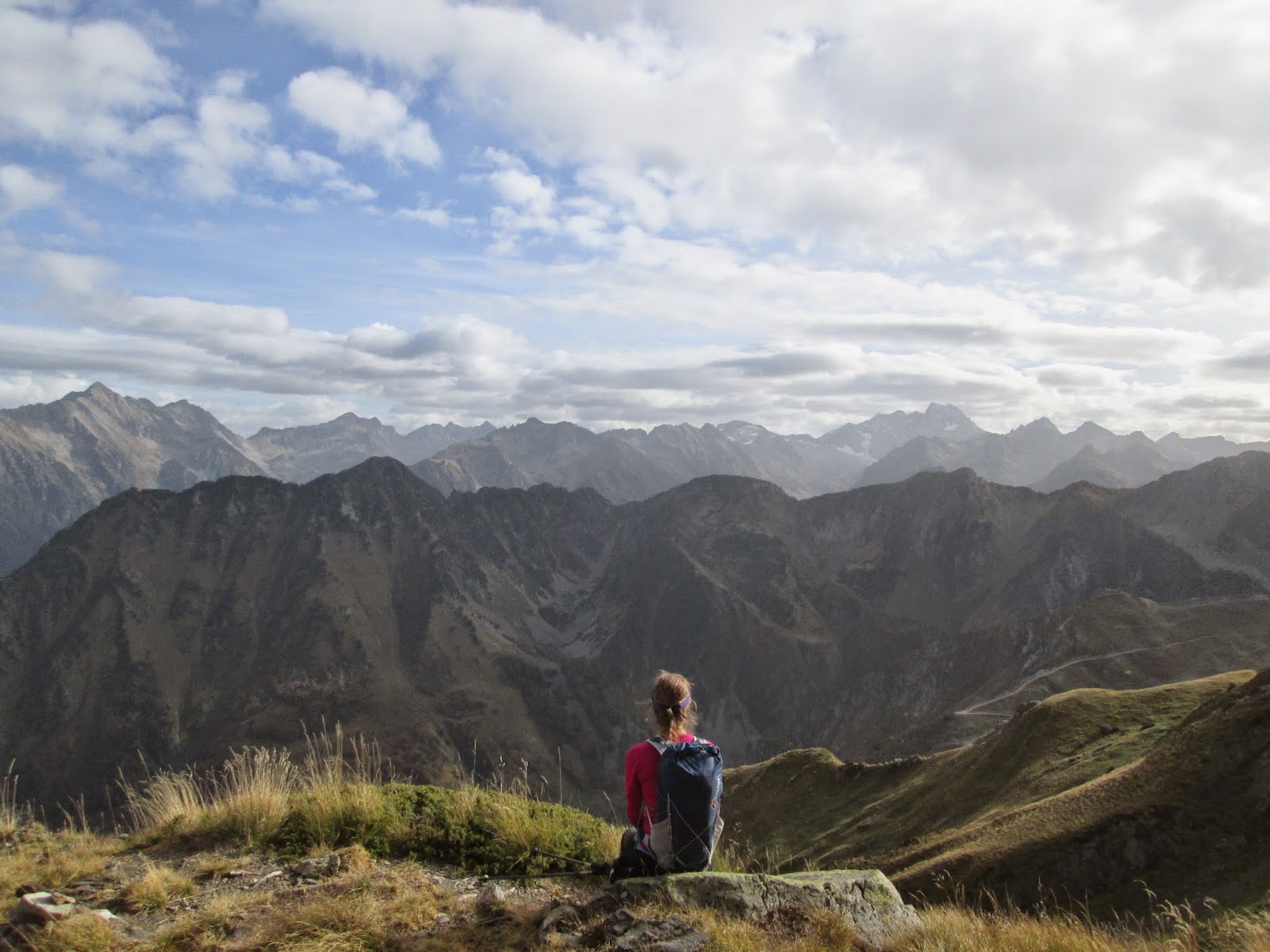
The late afternoon
sun cast a soft light on the slopes as our shadows grew longer and as
we passed 2000m altitude the view was just stunning. Looking south
into the highest parts of the Pyrenees we could make out the massive
summits of Vignemale, the Pic du Midi (and the Col du Tourmalet just
below that we had visited the day before) and countless others beyond
silhouetted against the sky. With nobody else on the mountain it felt
like a magical early evening, exclusively for just us two.
We eventually turned round at 2400m probably just an hour or less from the rocky top, but it would have been a push to get back before dark and we had already enjoyed so much of the view that we felt content to leave it for the day.
Walk Information:
Motorhome Base: Cauterets
Start/ End Point: Cauterets
Time It Took Us: 7 hours
Ascent: approx 1800m
Level: Hard
Map: Carte de Randonnees Cartes no.4 'Bigorre' 1:50.000
Hiking in the Hautes-Pyrénées & the Pyrénées National Park - Gavarnie & Cauterets
3 Big Hikes in the High Mountains of the Ariege-Pyrénées, France
See all Our Hikes in the Pyrenees
Road Cycling in the Hautes-Pyrénées - The Most Famous & Difficult Climbs of the Tour de France


No comments
Post a Comment