


Heading south from
Cauterets on Saturday lunchtime following the 'Chemin Demontzey' we
found ourselves back on our old friend, the GR10 which traverses the
French Pyrenees from the Atlantic to the Mediterranean. Having had an amazing 10 days trekking along this trail last Autumn we always liked
to see other parts of the trail and maybe one day we'll get the
chance to walk the whole thing. Our aim for today
was to head as far south as time would allow (given the short
daylight hours), first climbing along the 'Chemin du Cascades' (part
of the GR10) to reach Pont d'Espagne (1500m) from where the trail
turned towards the Lac de Gaubet (1800m) and onwards to the lower
slopes of the massive Vignemale.

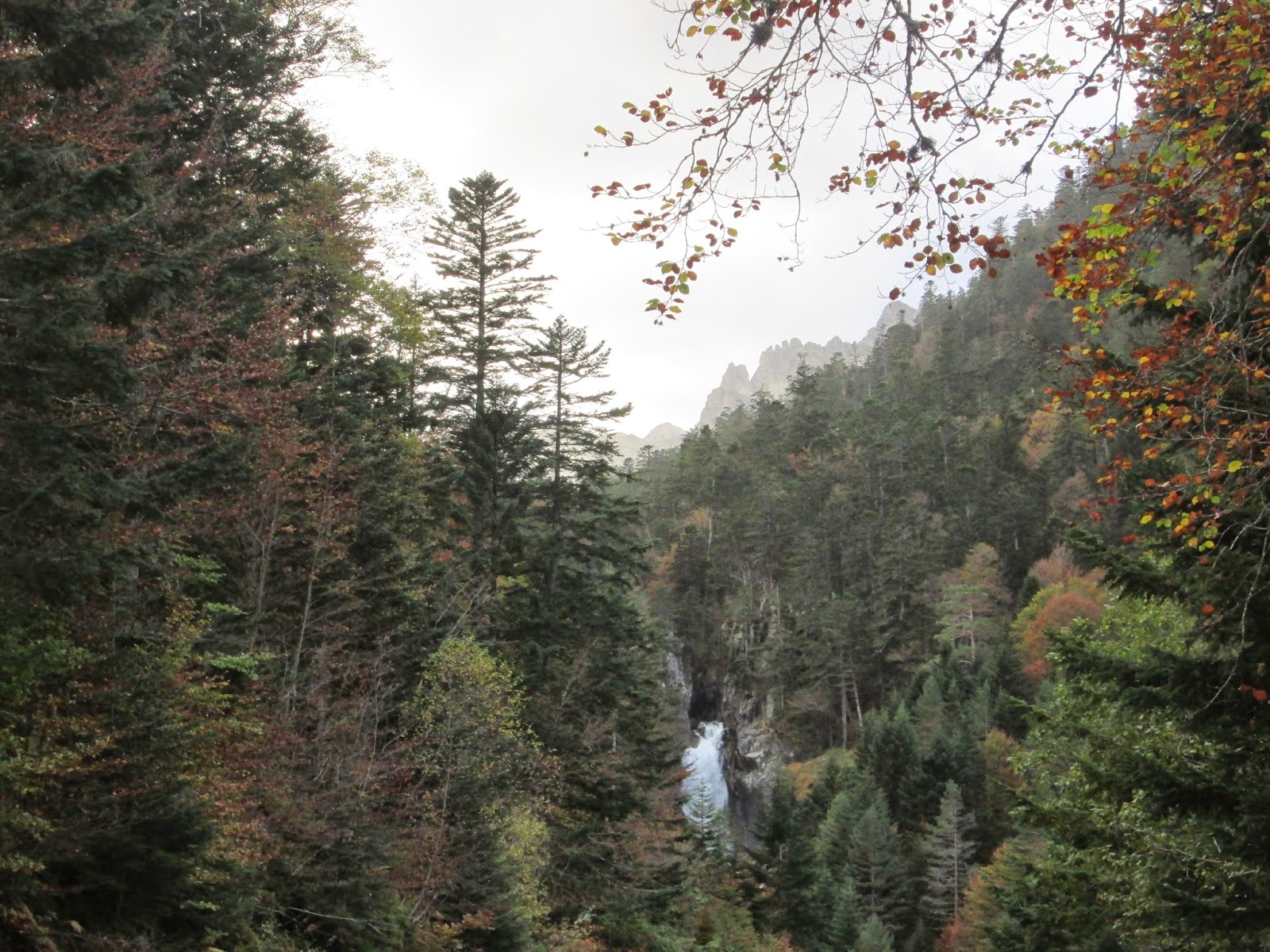
As the path began
to climb along the side of a tumbling stream, with frequent
waterfalls ranging in size from a few metres to fifty metres, we made
slow progress over the uneven ground. Sadly for us, despite the sunny
weather this steep sided valley and the late time of year meant that
we were in shade for the entire climb and the chilly air from the
water sapped our energy a little after a long hike the previous day.
This also meant that progress was a little slower than we had hoped
and although the waterfalls and the golden red and brown trees
surrounding us were beautiful we did find ourselves by the end
looking forward to some more open slopes and views above.

At Pont d'Espagne
we easily picked up the well signed trail to continuing following the
GR10 south, through slightly less dense forest now to reach the Lac
de Gaubet after a total of 4 hours of hiking. After spending most of
the hike in the shaded valley it was a welcome sight as we arrived at
the waters edge and the view opened to reveal the rocky, sheer sided
cliffs of Vignemale with the tumbling Glacier des Oulettes rising up
beyond the calm, blue waters fed by a high waterfall. It was stunning
and so we found a handy log to just sit and appreciate the sight for
half an hour.
By this point it
was quite late in the day and hunger was setting in, so polishing off
our remaining supplies we began the long trek homewards, retracing
our steps through the trees. Our return journey took a little under 3
hours and saw us arriving back in the dark and ravenous for dinner –
the motorhome was an even more welcome sight than usual!
Walk Information:
Motorhome Base: Cauterets
Start/ End Point: Cauterets
Time It Took Us: 7 hours
Level: Moderate
Map: Carte de Randonnees Cartes no.4 'Bigorre' 1:50.000
Other Related Posts:
Hiking in the Hautes-Pyrénées & the Pyrénées National Park - Gavarnie & Cauterets
3 Big Hikes in the High Mountains of the Ariege-Pyrénées, France
See all Our Hikes in the Pyrenees
Road Cycling in the Hautes-Pyrénées - The Most Famous & Difficult Climbs of the Tour de France
Walk Information:
Motorhome Base: Cauterets
Start/ End Point: Cauterets
Time It Took Us: 7 hours
Level: Moderate
Map: Carte de Randonnees Cartes no.4 'Bigorre' 1:50.000
Hiking in the Hautes-Pyrénées & the Pyrénées National Park - Gavarnie & Cauterets
3 Big Hikes in the High Mountains of the Ariege-Pyrénées, France
See all Our Hikes in the Pyrenees
Road Cycling in the Hautes-Pyrénées - The Most Famous & Difficult Climbs of the Tour de France


No comments
Post a Comment