Travelling east after our fantastic time at the Aletsch Glacier, we made our way slightly further along the upper Rhone Valley (also known as Obergoms) to reach the village of Oberwald. From here the road climbs uphill to the tiny hamlet of Gletsch at 1757 metres and just a few kilometres from the tongue of the Rhone Glacier. Situated at the crossroads of the Grimsel Pass and the Furka Pass, two of Switzerland’s most well known and popular high mountain driving routes, we decided to make use of the permitted motorhome parking offered by the hotel (10 CHF per night).

Over the next 2 days we cycled to the top of both of these passes, each time descending back to Oberwald to start the climb. For the Furka Pass, which tops out at 2429 metres, the climb from Oberwald was 16.5 km long at an average of 6.4%, an ascent of 1063 metres. It’s a tough climb but very beautiful. On our way down we stopped off close to the Belvedere Hotel and hiked out to a viewpoint over the Rhone Glacier, which is enormous and visually stunning. As the name suggests, this glacier is also the source of the Rhone river which runs through Europe all the way to Mediterranean Sea.
In fact, this particular region of the Swiss Alps sits upon the European Watershed. On one side of the mountains the water drains, ultimately, into the Atlantic Ocean, North Sea and Baltic Sea, w
hile on the other side drains into the Mediterranean Sea, Adriatic Sea and Black Sea. Also, four major rivers originate in this mountain range. The Rhone, as mentioned, but also the Rhine, Ticino and Rheuss. There is a hiking route which takes in the source of each known as the Vier Quellen Weg (Four sources way).
The Grimsel Pass climb from Oberwald is slightly shorter at 12.1 km and an average of 6.6%, topping out at 2165 metres. The final half of the climb involves seven tight and long hairpins which zig-zag up the almost sheer mountainside which is as scenically impressive as it is challenging.
After these two rides we spent the next four nights at the top of the Grimselpass itself, again in parking overseen by one of the restaurants at the top (10 CHF per night). Because, along with the Susten Pass and Furka Pass, the Grimsel Pass makes up an extended, high altitude road loop popular with drivers and cyclists, it is quite a busy place to be during the day. Lots of hikers and vehicles coming and going, whether to take a quick snapshot or spend a day in the hills. At night, however, it becomes blissfully quiet, with anything from a couple of dozen to just one or two motorhomes staying the night during our time there.

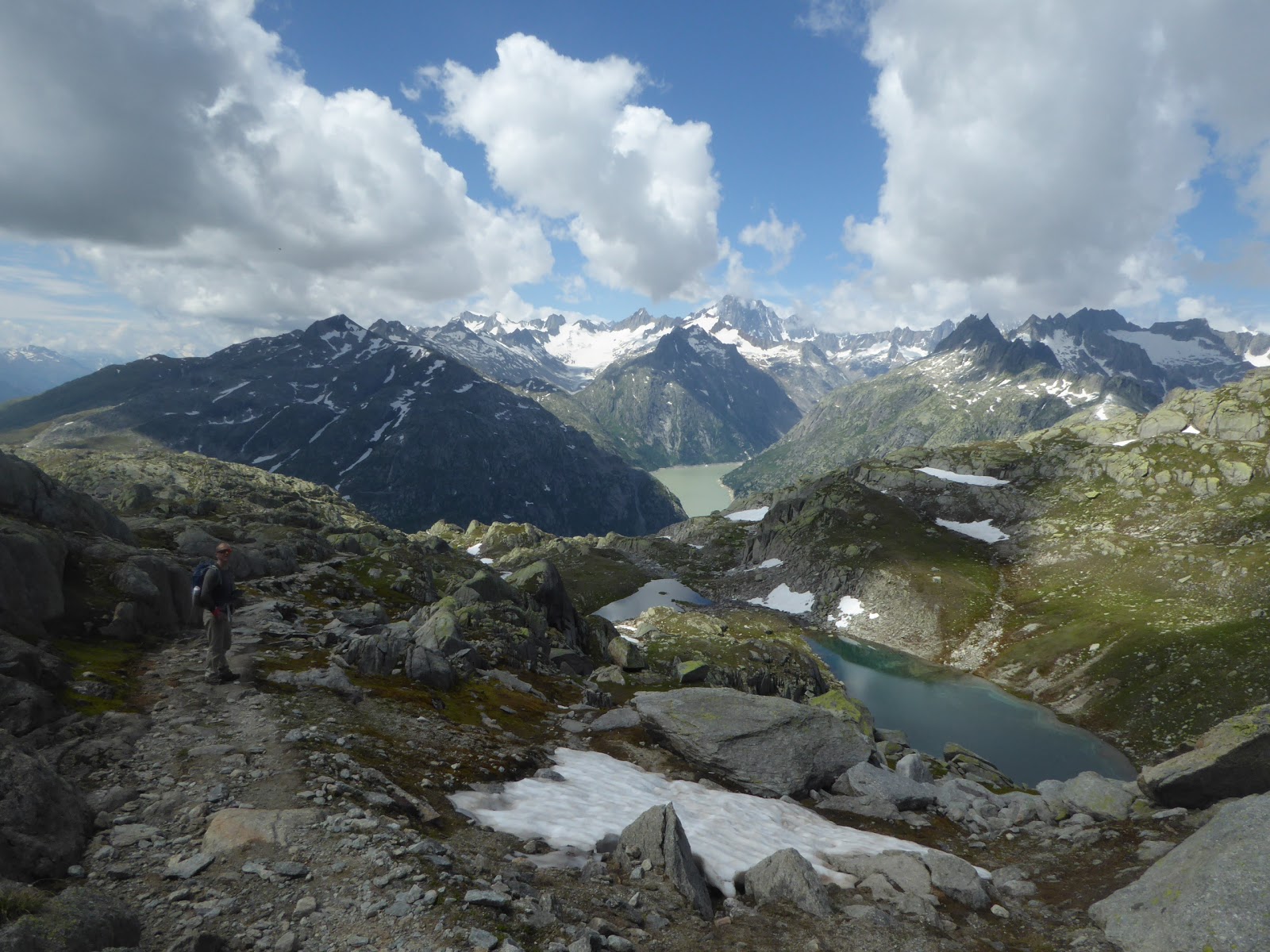
During our days at Grimsel Pass we hiked first up to the Sidelhorn, a 2764 metre peak which provides a magnificent view over the surrounding glacial valleys and their remaining glaciers. Part of the reason the scenery on display at Grimsel, and in fact in much of the region, is so spectacular because the evidence of the previously vast ice sheets which covered the area is so apparent. The word for a rocky outcrop which protrudes above a glacier or ice sheet is ‘nunatak’, and everywhere you look from Grimsel and the surrounding hikes you can see a clear distinction between the rough and sharp protrusions near the top of peaks and ridges, and the smoothed, slightly moss covered crags and boulders which line the sides of the valley. It’s amazing and fascinating to think, while looking down into a thousand metre deep valley, that it was once filled with hard, dense glacial ice.

Our second hike from Grimsel Pass was to the Rhone Glacier, providing a very different perspective from that offered on our descent from the Furka Pass. From where we hiked to on our four hour round trip, we could see the entire glacier as it extended up high into the mountains to it’s starting point. Very impressive.
Finally, on the day we left Grimsel Pass and headed north, we stopped and cycled back up to the top from the other side. Technically, starting at the very bottom in Innertkirchen, the entire climb is 26 km long with an average gradient of 5.9% (a climb of 1560 metres), which is a bit of a beast. Since we had run out of both food and gas and had a long drive ahead of us to the nearest LPG filling station, we decided to ‘only’ do the final 17 km, starting in Guttanen. From here to the top it was an average of 6.5%

Although there are quite a few tunnels on the road, most are short and the longest one we went through was avoidable via the old, open air road which is signposted for cyclists and pedestrians. The route was beautiful and, if I had to choose, was my favourite side of the two. Even though the climb up from Oberwald/Gletsch had involved those impressive switchbacks, this sweeping, winding route down the glacier carved valley was something else. Close to the top, passing the various dams which are constructed in the valley, and looking up at the peaks and crags was awe-inspiring.
Which brought us to the end of our busy time at Grimsel Pass. All that was left was to drive to Interlaken, fill up with food and gas, stop at a camping to recharge our motorhome facilities and then head back into the mountains.


 Although there are quite a few tunnels on the road, most are short and the longest one we went through was avoidable via the old, open air road which is signposted for cyclists and pedestrians. The route was beautiful and, if I had to choose, was my favourite side of the two. Even though the climb up from Oberwald/Gletsch had involved those impressive switchbacks, this sweeping, winding route down the glacier carved valley was something else. Close to the top, passing the various dams which are constructed in the valley, and looking up at the peaks and crags was awe-inspiring.


No comments
Post a Comment